


- 1:33 h
- 9.86 km
- 98 m
- 98 m
- 564 m
- 661 m
- 97 m
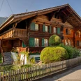
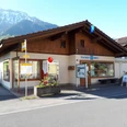
- Start: Tourism office Bönigen
- Destination: Tourism office Bönigen
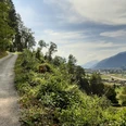
Along the lakeshore towards Iseltwald to the forestry house and then up a hill to the fallow deer enclosure. On the panoramic trail back towards Bönigen to the junction and ascent to Oberallmi. From Oberallmi towards Ankeweidli via a short trail running section to the Bömbergen. From here, it continues through the forest downhill to Acherhubel. Once on the plain, follow the signpost to Aenderbergbrügg. Before the bridge, turn right along the shore of the Lütschine and later cross the Lütschine via a small wooden bridge, continuing along the shore towards Bönigen until the second road bridge. From there, there is a section along the main road towards Interlaken until you turn right at Sendlistrasse and jog across the fields to a farm. From there, follow the lake back towards Bönigen to the starting point.

Good to know
Pavements
Best to visit
Directions
Directions & Parking facilities
Motorway exit Interlaken East / Bönigen if coming from Bern, Thun.
Motorway exit Bönigen if coming from Brienz.
By train to Interlaken East. From there, take bus 103 to the "Bönigen See" station. The bus runs every 30 minutes towards Interlaken or every hour towards Iseltwald.
To go back to Interlaken, take bus number 103 at the "Bönigen am See" stop just around the corner on the lakeside.
Additional information
Bönigen-Iseltwald Tourism
Seestrasse 6
CH-3806 Bönigen
T 0041 33 822 29 58
mail@boenigen-iseltwald.ch
www.boenigen.ch/tourismus
License (master data)
Author´s Tip / Recommendation of the author
- Short trail running section. This can be extended by following the signpost direction Sytiberg from the Bömbergen until the forest road starts and then back to the Bömbergen.
- At the end of the route, Lake Brienz awaits for a cool down.
- Parking (paid) and toilet available behind the Hotel Seiler au Lac.
Nearby


")

")