


- 5:20 h
- 10.59 km
- 1,778 m
- 92 m
- 567 m
- 2,344 m
- 1,777 m
- Start: Brienz
- Destination: Brienzer Rothorn
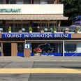
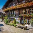
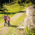
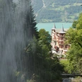
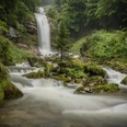
From Brienz station, one walks briefly westward to the Trachtbach, which devastated part of the village after heavy rainfalls in summer 2005. By the Catholic church, the path follows alongside the stream and ascends uphill. At the Wellenberg bridge, it passes under the track of the Brienz-Rothorn Railway and continues to climb steeply. It winds upwards through many switchbacks—mostly in the forest—quickly ascending. Larger rock blocks testify to landslides that have strongly shaped the landscape. Views of the lake and the opposite mountain ranges delight along the way.
At Gäldried, the railway track is crossed. While the rails soon disappear into tunnels, the alpine road leads again through the forest up to Egg. At the height of the former Planalp spa (now a holiday home), the tree line is reached.
At the beginning of the 14th century, a Walser colony from the Lötschental was established on Planalp; its origin is attributed to the same resettlement under Johann von Thurn that later settled Lötscher in the rear Lauterbrunnen valley. This is also where the Abplanalp family originates.
The path now follows the Mühlibach for a longer stretch. From Greesgi, the path becomes a trail leading along the slope into the Ober Stafel basin. On the ridge, the mountain station of the Rothorn Railway is already visible. The ascent continues in large switchbacks. The newly built (1991) terminal station of the railway, relocated to the mountain ridge for landscape protection reasons, is bypassed eastward, reaching the ridge height by Hotel Rothorn Kulm. Another 15 minutes are needed to the Brienzer Rothorn summit. At the Dreiländerstein, the cantons Bern, Lucerne, and Obwalden meet. The Brienzer Rothorn is also the highest peak on Lucerne soil. The wide panoramic view is one of the most magnificent in the Alpine region and includes, besides the mountains of the Bernese Oberland, large parts of Central Switzerland.

Good to know
Pavements
Best to visit
Directions
Equipment
Directions & Parking facilities
Outbound journey: By Zentralbahn from Interlaken Ost or Lucerne to Brienz.
Return journey: By Brienz Rothorn Railway to Brienz. Continue with the Zentralbahn.
Additional information
Literature
License (master data)
Safety guidelines
This route runs wholly or partly on marked paths of the mountain hiking trail category
Map
Nearby
")
")
