

 and Schwalmere (right).")
- 7:00 h
- 17.60 km
- 1,383 m
- 1,383 m
- 981 m
- 2,249 m
- 1,268 m
- Start: Aeschiried, schoolhouse
- Destination: Aeschiried, schoolhouse
"Morgenberghorn 4 hrs. 30 mins." The signpost at the schoolhouse in Aeschiried leaves no doubt: the way to the summit is long – and you want to get down again as well. So you should set off early. First intermediate goal is the Aeschispitz, a lovely viewpoint. From there the path leads over Bireberg and Greberegg to the Brunni hut. The ski club Leissigen runs the mountain hut with a dormitory. The northwestern flank of the Morgenberghorn towers impressively above the Alp Brunni. Through an apparently insurmountable barrier winds a chain-secured chimney. The easy climbing through the "Chemi" is quick, then we ascend the long west ridge to the summit. On top stands a forged iron flag, painted with a Swiss cross and Bernese bear. A summit logbook is also deposited.
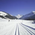
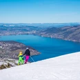
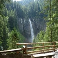
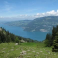
The Morgenberghorn offers a 360° panoramic view. Far below lie Lake Thun and Lake Brienz, and around stand a whole series of walkable summits: Augstmatthorn, Niederhorn, Sigriswiler Rothorn, Niesen, Wätterlatte, Dreispitz and Schwalmere. At some point, you should think about the descent, because the return is still far. Down the south ridge, partly secured with chains and scree. Impressive are the deep views into the valleys of Saxeten and the Latrejenalp. At the Rengglipass, the passage from the Saxet valley into the Suldtal, then begins the leisurely part: over the alpine huts of Mittelberg, along the Latrejebach, to the viewpoint bench with a view of the 80-meter-high Pochtenfall and finally through the romantic Suldtal.

Good to know
Pavements
Best to visit
Directions
From Aeschiried (1015 m) via the Aeschiallmi to the Spitz (1393 m). Continuing over Bireberg (1420 m) and Greberegg (1550 m) to the Brunni hut (1644 m). Steep ascent at the foot of the Morgenberghorn and through a chain-secured chimney to the west ridge. Over the ridge steep but not very difficult to the summit (2249 m). Caution on the descent via the south ridge: A scree section is secured with chains. From the Rengglipass (1879 m) over alpine meadows to Mittelberg (1525 m), along the Latrejebach past Schlieri (1425 m) and Lauenen (1370 m) to the viewpoint (bench) at the Pochtenfall. In a few minutes fully down to the Gasthaus Suld (1080 m), from here about an hour downhill to Aeschiried.
Variants: From the Rengglipass you can also descend to Saxeten (PostBus) in about 1.5 hours and to Wilderswil (rail connection) in about 2.75 hours.
Equipment
Directions & Parking facilities
By train to Spiez, then PostBus to Aeschiried Schulhaus.
From July to early October, on Saturdays, Sundays and public holidays, the Suldtal bus (PostAuto scheduled service) runs on the route Aeschiried - Suld (Gasthaus im Suld) - Aeschiried. A single ride costs 5.00 CHF per person. For groups of 10 or more people, reservation is required: Tel. +41 (0) 848 100 222.
Additional information
Aeschi Tourism, Tel. +41 (0) 33 654 14 24, www.aeschi-tourismus.ch
Places to eat, e.g.:
Brunni hut (May to October on weekends), Tel. +41 (0) 77 438 08 65, www.scleissigen.ch
Sennhütte Mittelberg (May to October), Tel. +41 (0) 33 654 20 73.
Gasthaus Suld in the Suldtal, Tel. +41 (0) 79 560 17 14, www.gasthaus-suld.ch
Literature
Jochen Ihle / Toni Kaiser: The 55 most beautiful hikes in the Bernese Oberland. ISBN 978-3-03865-073-7, Rothus Medien, Solothurn, www.wandershop-schweiz.ch
Jochen Ihle / Toni Kaiser: The 99 most beautiful circular routes in Switzerland. ISBN 978-3-03865-059-1, Rothus Medien, Solothurn, www.wandershop-schweiz.ch
Jochen Ihle / Toni Kaiser: The 101 most beautiful hikes in Switzerland. ISBN 978-3-03865-041-6, Rothus Medien, Solothurn, www.wandershop-schweiz.ch
Sabine Joss / Fredy Joss: The 88 most beautiful summit tours in Switzerland. ISBN 978-3-03865-071-3, Rothus Medien, Solothurn, www.wandershop-schweiz.ch
License (master data)
Author´s Tip / Recommendation of the author
From Greberegg you could descend in just under an hour to the Gasthaus im Suld, then it is a nice half-day round trip.
Safety guidelines
Map
Map 1:50 000, 254T Interlaken.
Nearby

