


- 5:10 h
- 15.45 km
- 600 m
- 830 m
- 791 m
- 1,411 m
- 620 m
- Start: Aussereriz/Losenegg
- Destination: Sigriswil
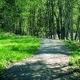
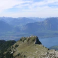
From the Losenegg bus stop in Aussereriz past individual farms on the small road down to the Zulg, often crossing deeply incised ravines. On the covered Koppisbrügg, it goes over the narrow Zulg ravine and immediately upwards to the shaded hillside path. Past the large farm Neuhus, one reaches the schoolhouse of Horrenbach and ascends directly over the scenic pasture ridge of Huetweid to the Hubel house. Throughout the entire ascent, you can enjoy wonderful views of the flank of Hohgant and the Burst. In Tüelboden, a forest-fringed saddle in the pasture ridge, the indistinct path is chosen, which leads straight over the ridge to Ruerwald and crosses it. In the next forest clearing, at Alp Schnabel, the path continues level along the forest road over the pastures and in a wide arc through the Tönimoos to Dünzenegg, where the view opens towards Sigriswilgrat and Schwanden.
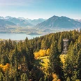
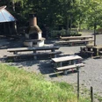
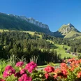
Continuing level, you reach the mountain farm Oberi Matte and from there gently descend over pastureland and through mountain forest past the Stampf picnic area to Schwanden/Sagi. A farm road leads further to Schwanden, then a narrow path goes down into the idyllic Büelgraben. The view from the sunny terrace of Sigriswil onto the lake and the pre-Alpine peaks and firn domes of the central Bernese Oberland is magnificent.

Good to know
Pavements
Best to visit
Directions
Aussereriz/Losenegg - Horrenbach - Schwanden/Sagi - Sigriswil
Equipment
We recommend the following equipment: light trekking shoes, light backpack, sun protection, rain jacket, pocket first aid kit, light picnic, sufficient liquids, mobile phone.
Directions & Parking facilities
Arrival: By train to Thun. Then by STI bus no. 41 to Aussereriz, Losenegg stop.
Return: From Sigriswil village by STI bus no. 24 or 25 via Oberhofen to Thun.
Additional information
Bernese Hiking Trails Association, Bern, Tel.: 031 340 01 01, E-Mail: info@beww.ch, Homepage: www.bernerwanderwege.ch
Literature
Hiking suggestion from the hiking book Thunersee - Frutigland, hiking book series of the BWW
License (master data)
Safety guidelines
This route runs exclusively on signposted paths categorized as hiking trails
Map
Swisstopo hiking map 254T Interlaken 1:50,000
Nearby


")
")