- 4:20 h
- 12.60 km
- 900 m
- 900 m
- 941 m
- 1,643 m
- 702 m
- Start: Zweisimmen
- Destination: Zweisimmen
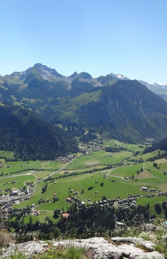
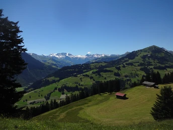
From Zweisimmen station to the town centre, cross the Kleine Simme and at the next opportunity ascend into the forest. Soon you enjoy a magnificent view over the wide valley floor to the rocky peaks of the Spillgerte group. The path leads through a forest tongue and turns at point 1070 onto the forest road in the Vorderwald. This gently rising road leads into the meadow hollow of Chäleweid and crosses as a path the tree-studded mountain slope to the Flüewald (to Holaas–Heimchueweid 1h10). Impressive is the view of the scattered settlement of Oeschseite on the opposite valley side. The path then ascends more steeply through small rock bands to the huts of Schauenegg on treeless pasture, where it turns at right angles to the nearby viewpoint. The name Schauenegg is quite fitting, as from here you enjoy a magnificent view of the Saanenmöser and a part of the Saanenland with Gummfluh and Le Rubli.
Continue ascending on the west flank of the ridge to Hindere Schwarzesee and through hilly terrain past the dreamy mountain lake to the alpine hut Vordere Schwarzesee (to the bus stop at Sporthotel Sparenmoos 5 min). The detour to the small lake about 30 m lower in a hollow is not advisable, as its shores are partly very marshy. For about 300 m, you then use the road, before a forest track leads over Sparemoos into the upper part of the Beret valley, through which you descend to Heimchueweid. Once again, you enjoy the magnificent distant view up and down the valley before the descent through the Vorderwald begins. At point 1070, the circular route is closed and after crossing a short stretch of forest you find yourself directly above the village of Zweisimmen.
The descent to the station follows the already known route.
Good to know
Pavements
Best to visit
Directions
Equipment
Directions & Parking facilities
Additional information
License (master data)
Safety guidelines
Map
Nearby


