- 3:00 h
- 6.23 km
- 820 m
- 260 m
- 1,499 m
- 2,315 m
- 816 m
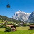
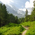
- Start: Wengen (Allmend)
- Destination: Kleine Scheidegg

Good to know
Pavements
Best to visit
Directions
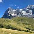
Kleine Scheidegg - Lauberhorn - Hundschopf - Allmend
Equipment
Wir empfehlen folgende Ausrüstung: Feste Bergschuhe, mittelgrosser Rucksack mit Hüftgurt, Sonnenschutz, Regenbekleidung, Wanderstöcke, Taschenapotheke, Picknick, genügend Flüssigkeit, Mobiltelefon.
Directions & Parking facilities
Kostenpflichtige Parkplätze im Parkhaus Lauterbrunnen
Hinreise: Ab Bern via Spiez, Interlaken Ost, Lauterbrunnen, nach Wengen, Allmend
Rückreise: Ab Kleine Scheidegg via Lauterbrunnen, Interlaken Ost nach Bern
Additional information
Verein Berner Wanderwege, Bern, Tel.: 031 340 01 01, E-Mail: info@beww.ch, Homepage: www.bernerwanderwege.ch
License (master data)
Safety guidelines
Diese Route verläuft ganz oder teilweise auf signalisierten Wegen der Kategorie Bergwanderweg.
Map
Nearby