- 6:30 h
- 15.50 km
- 1,300 m
- 1,400 m
- 1,174 m
- 2,386 m
- 1,212 m
- Start: Adelboden
- Destination: Kandersteg
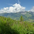
From the village centre of Adelboden, you first descend to Müliport on the Engstlige. From there, an asphalt path leads over Eggetli to Ahorni. Beyond the Bunderlebächli, a path climbs steeply through the forest to the pastures of Bunderalp. The view up to the vertical cliffs of the Nünihorn on Gross Lohner is breathtaking. Zigzagging steeply through rubble slopes, you reach the grass-covered bowl of Bunderchumi. You reach the sharp notch of the Bunderchrinde between Gross and Chlyne Lohner (Chrinde = notch, groove) on very steep trail tracks over a schist scree slope. Turning northwards, you reach a fork at point 2254 on a narrow mountain path crossing the southeast flank of Chlyne Lohner. The path then curves widely southwards down to the huts of Alpschele. Over the alpine terrace, you arrive at a rock band, which you descend very steeply with many zigzag turns to Usser Üschene. The massively towering spur of the Gällihorn is bypassed along the Alpbach. Across meadows and through forest, crossing the alpine road on the way, you descend to the meadows of Eggeschwand. A magnificent promenade leads along the Kander to Bütschels and, passing under the railway line, to Kandersteg train station.

Good to know
Pavements
Best to visit
Directions
Equipment
Additional information
Literature
Hiking suggestion from the hiking book Thunersee - Frutigland, hiking book series of the Bernese hiking trails
License (master data)
Safety guidelines
Map
Swisstopo hiking map 1:50,000 263T Wildstrubel
Nearby