- 1:30 h
- 5.05 km
- 80 m
- 49 m
- 595 m
- 665 m
- 70 m
- Start: Meiringen
- Destination: Innertkirchen
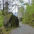
From Meiringen train station (to the Reichenbach Falls via the Sherlock Holmes Trail 1h10; via the Schattenhalber Cultural Path over Schwendi–Geissholz to Meiringen 2h30; to Innertkirchen 2h15) walk along the main road downstream to the bridge over the Alpbach. Keeping the direction, cross the brook and walk through the straight avenue to the hamlet of Sand. Cross the Aare on the Sand bridge. Here the two variants split: The old Grimsel edge path leads diagonally up into the forest, then along a nearly flat stretch and finally climbs to the height of the Kirchet, the rock ridge at whose foot the former Aare lake spread. A hiking trail built parallel to the heavily trafficked pass road passes by the Lammi guesthouse and cuts across the wide hairpin bends of the road to the east entrance of the Aare Gorge, where the two variants reunite (10 min to the railway station).
Those who want to walk through the Aare Gorge, open from early April to the end of October, follow the road after the Sand bridge and reach the west entrance through the building of the Aare Gorge restaurant (entrance fee). The gorge is an impressive testimony from the last ice age. When glaciers still extended far into the valley, deep incisions were formed under the ice by meltwater in older fracture zones in the limestone crossbar of the Kirchet. Debris and water acted as relentless files and formed countless niches, grottos, kettles, bays, oriels and vaults. At the narrowest places, the steeply rising walls come together at less than one meter. The 1400 m long and 100–200 m deep Aare Gorge can now be comfortably and safely walked on the footbridge and through tunnels built with great effort in 1888/89.
From the east entrance, a footpath leads down to the Aare dam, from where Innertkirchen is reached on a level path.

Good to know
Pavements
Best to visit
Directions
Meiringen - Sand bridge - Lammi - Aare Gorge - Innertkirchen
Equipment
We recommend the following equipment: lightweight trekking shoes, light backpack, sun protection, rain jacket, first aid kit, light picnic, sufficient fluids, mobile phone.
Additional information
Bern Hiking Trails Association, Bern, Tel.: 031 340 01 01, e-mail: info@beww.ch, homepage: www.bernerwanderwege.ch
Literature
Hiking suggestion from the Jungfrau Region Brienz Lake – Oberhasli hiking book, series of the Bernese Hiking Trails
License (master data)
Safety guidelines
This route runs exclusively on marked paths of the hiking trail category.
Map
Swisstopo hiking map 1:50,000 255T Susten Pass
Nearby