- 2:00 h
- 7.46 km
- 57 m
- 22 m
- 970 m
- 1,049 m
- 79 m
- Start: Rougemont
- Destination: Gstaad
Why does the Saane form a language boundary? This has a historical background. In the 3rd century, the Alemanni occupied the east of the Swiss territory and the Burgundians the west. At that time, the Aare formed the border of the two population groups. Only centuries later was the border shifted to the Saane. Since the founding of the city of Freiburg, the creation of a bilingual capital, the two cultures, the German-speaking east and the French-speaking west, have been connected.
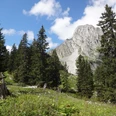
At the starting point of the route, the Rougemont train station, you should follow the signs Le Revers and Saanen. Crossing the railway line leads to the Sarine, as the Saane is called in French, to Les Revers. From here, the destination Gstaad is marked on the signposts. The route now runs through the forest or along the forest edge, always near the Saane. Without noticing it, you have crossed the language boundary and moved from the canton of Vaud onto Bernese ground; the boundary stone is easy to overlook. A footbridge at the western end of the runway of Saanen airfield leads to the north bank. Along Saanen station, one continues to follow the Saane. Countless benches and several rest areas invite you to rest and linger. Finally, after the bridge at Mettlen, turn left. In short, the destination, Gstaad station, is reached. It is worth strolling through the car-free center of Gstaad before the return trip.

Good to know
Pavements
Best to visit
Directions
Rougemont – Les Revers - Dorfrüti - Saanen – Mättlen - Gstaad
Equipment
We recommend the following equipment: Light trekking shoes, light backpack, sun protection, rain jacket, pocket pharmacy, light picnic, enough fluids, mobile phone.
Directions & Parking facilities
Outbound trip: By train via Spiez and Zweisimmen to Rougemont or via Bulle and Montbovon to Rougemont
Return trip: By train from Gstaad via Zweisimmen and Spiez and onwards or via Montbovon and Bulle and onwards
Additional information
Bernese Hiking Trails Association, Bern, Tel.: 031 340 01 01, E-Mail: info@beww.ch, homepage: www.bernerwanderwege.ch
Literature
Hiking book Short hikes 2 of the Bernese hiking trails
License (master data)
Safety guidelines
This route runs exclusively on marked paths of the hiking trail category.
Map
Swisstopo hiking map 262 T Rochers de Naye and 263 T Wildstrubel 1:50,000
Nearby