


- 4:00 h
- 8.57 km
- 440 m
- 440 m
- 1,077 m
- 1,455 m
- 378 m
- Start: Schwanden (Sigriswil) / Säge
- Destination: Schwanden (Sigriswil) / Säge
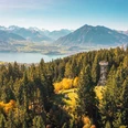
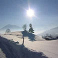
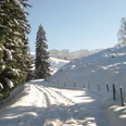
The Dünzenegg Trail leads shortly from the starting point first up to the water reservoir. It then goes moderately steeply, alternating through forest and over meadows to the Stampfhütte. From there you have a magnificent view of Lake Thun and the snow-covered Bernese Alps. The path then leads almost flat to Underi Matte, where the shorter Rüeggers Trail branches off to the left. The longer Dünzenegg Trail leads to the Oberi Matte alpine hut. Then it goes through light forest to Schonegg. From the edge of the forest, there is a wonderful view into the Emmental. It continues up to Dünzenegg and then along the alpine road to the forest entrance. The trail passes Rüeggers Lischenhütte, a place of absolute silence. From Zenggisboden, follow the path back.

Good to know
Pavements
Best to visit
Directions
Schwanden / Säge – Underi Matte – Dünzenegg – Schonegg – Schwanden / Säge
Equipment
Equipment: snowshoes, ski poles, sturdy, high, grippy and waterproof mountain or winter hiking boots, cold and sun protection, first aid kit, food and warm drinks, mobile phone, possibly gaiters
Directions & Parking facilities
Starting and finishing point: Schwanden (Sigriswil) / Säge by bus to Schwanden (Sigriswil) / Säge, change in Oberhofen a.T. / Dorf
Additional information
Berner Wanderwege, 031 340 01 01, info@beww.ch, bernerwanderwege.ch
License (master data)
Author´s Tip / Recommendation of the author
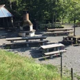
• Sirius Planetarium Observatory, Schwanden ob Sigriswil, 033 251 02 44
Variant: Rüeggers Trail
Difficulty: easy | Fitness: medium | 4.7 km | 2 h 45 min | 260 m ascent and descent
Safety guidelines
Difficulty: medium (red) / Fitness: difficult
Signage
This route is signposted as a snowshoe trail, but not specially prepared.
Avalanches
Increased avalanche danger in spring and during sudden weather changes. Helpful but not obligatory are an avalanche transceiver (LVS device), probe and shovel. Inform yourself about snow conditions and possible avalanche dangers before the tour.
Behavior
Do not take unnecessary risks and respect your limits. Always stay on the marked routes. Avoid wildlife if possible, behave quietly. Observe animals from a distance. Pack up your waste and leave no unwanted traces.
Map
swisstopo map: 1208 Beatenberg, 1:25,000
Nearby


