- 5:40 h
- 42.55 km
- 1,372 m
- 1,372 m
- 860 m
- 1,603 m
- 743 m
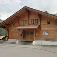
- Start: Habkern
- Destination: Habkern
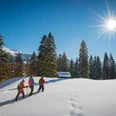
This tour leads through one of the most beautiful upland moor landscapes in the Bernese Oberland. It is characterized by a magnificent mountain backdrop, a unique natural habitat, lush meadows and green forests. From the start in the village of Habkern, the route ascends along asphalted and gravel roads towards the Grünenberg Pass. This is followed by an exhilarating, somewhat uneven descent into the valley with views of the Hohgant summit. Ride through an idyllic landscape on your way to Kemmeriboden Bad, where the delicious meringues are always worth stopping for! After a well-earned break, the final ascent to Harzisboden beckons. Once you reach the top, a stunning landscape unfolds. Continue through upland moorlands to the highest point on Lombachalp, where it's time for another short break. Superb views of the mountains and Lake Thun are your constant companions as you head back downhill along the asphalted road back to Habkern and your starting point.

Good to know
Pavements
Best to visit
Directions
Directions & Parking facilities
Additional information
Interlaken Tourismus
Marktgasse 1
CH-3800 Interlaken
0041 33 826 53 00
mail@interlakentourism.ch
www.interlaken.ch
Tourismusbüro Habkern
Im Holz
CH-3804 Habkern
0041 33 843 82 10
info@habkern.ch
www.habkern.ch
License (master data)

Author´s Tip / Recommendation of the author
Nearby