- 6:00 h
- 14.58 km
- 1,300 m
- 1,250 m
- 959 m
- 2,139 m
- 1,180 m
- Start: Blankenburg
- Destination: Matten
From the Blankenburg stop towards the main road and the village district of Betelried. The castle Blankenburg, located slightly to the south and serving as a Bernese administrative seat since 1386, is a successor building to the castle of the lords of Weissenburg, which burned down completely in 1767. The administrators at Blankenburg Castle did not have to live modestly, as shown by the house of Landseckelmeister Hans Peter Grünenwald in Betelried with its lavish carvings and paintings.
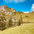
Through the Betelriedgrabe with its strong constructions and through the extensive coniferous forests of Grueholz, the path steeply climbs to the alp Vehsattel, surrounded by mountains and forest. Through the tree-covered alpine basin between Chörbelihore and Gandhore, the path now ascends steeply to the huts on Ussers Höuw-Eggli (to St. Stephan/Grodey 2h, steep and rocky). But the effort is not yet over, as another 100 m of elevation difference must be overcome. At Höuw-Eggli, the passage to Färmeltal, you are richly rewarded for your effort. Here, and especially from the nearby Mieschflue, you enjoy probably the most beautiful view of the hiking area of St. Stephan. Deep below, the rooftops in the valley floor of Färmeltal can be seen. Beyond that, some of the best-known Bernese Oberland peaks are visible. Above the upper part of the Simmental, the snowfields of the Wildstrubel-Wildhorn area shine. To the west, Wistätthorn and Giferspitz rise. Rocher de Naye and some rocky spires in Savoy can also be spotted. Deep below lies the end of the huge debris slope at Gandhore; the climbing peaks of Spillgerte stand close by.
The descent is extremely steep through scree fields to Inners Höuw-Eggli and through loose trees and forest to Dachbode (to Färmel/Stalde–Matten 1h20). The continuing soft, flat meadow path is doubly enjoyable after the steep descent. On the scenic terrace above Gfellweideni, the path joins the alpine road, follows it briefly, and from Scharbenne leads directly into the Gandbodewald and to the Zälgbach. Along this, the path descends in a straight line to the village district Bifang, where magnificent old Simmental houses can be admired.

Good to know
Pavements
Best to visit
Directions
Equipment
We recommend the following equipment:
Sturdy mountain boots, medium-sized backpack with hip belt, sun protection, rainwear, hiking poles, first aid kit, picnic, sufficient fluids, mobile phone.
Directions & Parking facilities
Getting there: By train to Zweisimmen and from there onward to Blankenburg.
Return: By train from St.Stephan.
Additional information
Literature
License (master data)
Safety guidelines
Map
Nearby