


- 6:00 h
- 13.60 km
- 1,800 m
- 135 m
- 607 m
- 2,144 m
- 1,537 m
- Start: Wimmis
- Destination: Stockhorn
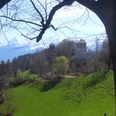
From Wimmis station, pass through the underpass, under the railway line and the motorway, and cross the Simme in the floodplain forest on the Brodhüsisteg. With increasing incline, a forest path winds up in many hairpin bends to Sattelegg. Soon you reach the small road coming up from Reutigen. Follow this to Alp Günzenen (from Reutigen 1h, very steep; via Chrindi–Allmenden to Oey-Diemtigen or Erlenbach 2h10; via Lengenberg to Matten 1h10). Here you turn to the lowest point of the ridge, to Chrindi. Only gently ascending, you go up to the large Alp Obers Heiti, where a magnificent panoramic view delights. Now a nearly level path leads around the Heitihubel to Alp Matten. Through the quiet rocky valley of Steinig Nacki, the path winds below the steep slopes of the Nüschleten to the Sattel of Furgge. Suddenly, the deep view of the lovely Hinterstockensee opens up. Almost level path crosses now the steep flank of Lasenberg. Below the Solhorn, you descend briefly towards the Oberbärgli alpine hut (to Oberbärgli–Chrindi 25 min). Through the green basin of Chummli, where in summer a considerable cattle herd grazes, you now reach Stockenfeld and ascend steeply to the Panorama Mountain House and the cable car mountain station at Stockhorn. Here there is already busy activity early in the morning: excursionists, hikers, flower enthusiasts and paragliders do not want to miss the Stockhorn experience.
The ascent to the summit takes place on the flower educational trail. The (available at the valley station of the Stockhorn cable car) small geological, zoological, botanical guide “From Chrindi to Stockhorn” provides insight into the geological conditions and the biodiversity of this Alpine foothill mountain. But incomparable is also the panoramic view from the Stockhorn summit. A special attraction are the two Stockhorn windows in the north face of the pre-Alpine summit, which can be reached through a tunnel. The deep view of Thun and its surroundings is overwhelming.

Good to know
Pavements
Best to visit
Directions
Wimmis - Günzenen - Obers Heiti - Steinig - Stockhorn
Equipment
We recommend the following equipment: sturdy mountain boots, medium-sized backpack with hip belt, sun protection, rainwear, hiking poles, first aid kit, picnic, enough fluids, mobile phone.
Directions & Parking facilities
Outbound journey: by train to Wimmis.
Return journey: by cable car to Erlenbach. Then from Erlenbach train station by train.
Additional information
Association Bernese Hiking Trails, Bern, Tel.: 031 340 01 01, e-mail: info@beww.ch, homepage: www.bernerwanderwege.ch
Literature
Hiking suggestion from the hiking book Simmental - Saanenland, hiking book series of the Bernese Hiking Trails.
License (master data)
Safety guidelines
This route runs entirely or partially on mountain hiking trails.
Map
Swisstopo hiking map 1:50,000 253T Gantrisch
Nearby


")
")
")