- 2:15 h
- 6.14 km
- 303 m
- 303 m
- 1,910 m
- 2,076 m
- 166 m
Interlaken-Oberhasli: Hiking route
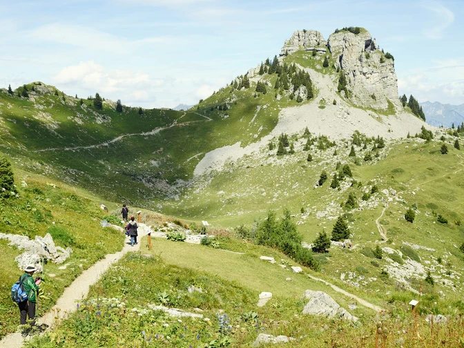
Start your adventure at the Schynige Platte Railway summit station and embark on a breathtaking circular hike that first takes you to the picturesque Daube vantage point. From here, take the well-maintained ridge trail that leads you along a secured path around the striking Oberberghorn. On this route, you will not only see a wide variety of flora – including thousands of alpine flowers – but you will also have the chance to observe marmots in their natural colonies.
The hike offers spectacular panoramic views throughout and takes you to the stunning Loucherhorn, from where you can enjoy a unique Alpine panorama. After a short rest at the Grätli signpost, you can resume the route in almost the opposite direction. Passing the idyllic huts of the Oberberg, you will finally get back to the starting point.
Good to know
Pavements
Best to visit
Equipment
Normal hiking equipment, hiking boots with non-slip soles, optionally a specialist book on identifying alpine flora.
Directions & Parking facilities
Via Bern or Lucerne to Interlaken. Or from the south, via the Grimsel Pass (summer only) or the Simplon Pass and the Lötschberg car-transport train to Interlaken. Wilderswil is not far from the exit towards Grindelwald/Lauterbrunnen.
Uncovered car park behind Wilderswil railway station.
With the Bernese Oberland Railway or by car to Wilderswil. The historic Schynige Platte Railway runs across the Breitlauenen Alp to the Schynige Platte. Travel time from Wilderswil: 53 minutes.
Additional information
Hike 61 (you also have the option of taking a detour to the Loucherhorn).
(in the printed summer panorama map of Jungfrau Railways)
License (master data)
Nearby


