


- 5:30 h
- 13.36 km
- 945 m
- 969 m
- 1,086 m
- 2,046 m
- 960 m
- Start: Saxeten
- Destination: Isenfluh
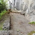
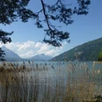
The small mountain village of Isenfluh, the destination of this stage, is located with a view above the Lauterbrunnen Valley. Those coming from above are already impressed by the might of the famous trio Eiger, Mönch and Jungfrau. And even more so by the rugged forest and rocky landscape between the magnificent viewpoint Bällehöchst, the Chüematte plateau with the attractively placed Lobhornhütte SAC and the "energy-charged" Soustal. Especially Chüebodmi, Fritzenbrüggli and the Sulsseeli are considered such places. The Saustal with its downward rushing stream and the large boulders invites you to rest and play in nature – ideal for families. Along the way you also pass the Suls-Lobhornhütte, which is located northeast of the Lobhörner on a high plateau of the Sulsalp and belongs to the SAC section Lauterbrunnen. Those who want to shorten the long day a bit can float down to Isenfluh with the rather old cable car from Sulwald, which saves about 500 meters of altitude (033 855 22 49, isenfluh.ch).

Good to know
Pavements
Best to visit
Directions
Equipment
Directions & Parking facilities
Arrival: By train to Wilderswil, then by bus to Saxeten.
Return: From Isenfluh by bus to Lauterbrunnen, there connection to train.
Additional information
Lauterbrunnen Tourism, Tel. +41 (0) 33 856 85 68, www.lauterbrunen.swiss
Cable Car Isenfluh–Sulwald, Tel. +41 (0) 33 855 22 49, www.isenfluh.ch
Restaurants and accommodations, for example:
Suls-Lobhornhütte SAC, Tel. +41 (0) 79 656 53 29, www.lobhornhuette.ch
Sulwald-Stübli at the mountain station of the Isenfluh-Sulwald cable car, Tel. +41 (0) 33 855 12 51, www.sulwald.ch
Hotel Waldrand, Isenfluh, Tel. +41 (0) 33 855 12 27, www.hotel-waldrand.ch
Literature
Jochen Ihle / Toni Kaiser: The 55 most beautiful hikes in the Bernese Oberland. ISBN 978-3-03865-073-7, Rothus Medien, Solothurn, www.wandershop-schweiz.ch
Jochen Ihle / Toni Kaiser: The 101 most beautiful hikes in Switzerland. ISBN 978-3-03865-041-6, Rothus Medien, Solothurn, www.wandershop-schweiz.ch
Wandermagazin SCHWEIZ, Special issue 1/2022: ViaBerna. Rothus Medien, Solothurn, www.wandermagazin-schweiz.ch
License (master data)
Author´s Tip / Recommendation of the author
Safety guidelines
Map
Nearby
