- 2:25 h
- 5.58 km
- 428 m
- 405 m
- 1,368 m
- 1,774 m
- 406 m
- Start: Pfingstegg summit station
- Destination: Pfingstegg summit station
The UNESCO theme trails are digitally accessible via smarTrails (only in german). All you need is this link and an internet-enabled smartphone. Alternatively, you can also book guided tours here.
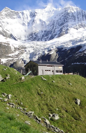
The hike from Pfingstegg to Bäregg is not only scenic but also educational. At seven locations you will learn how the spectacular rockfall on the Eiger occurred, why the resulting glacial lake is a danger and how the picture of a mountain hut on the precipice became a symbol for the possibly dramatic consequences of climate change in Europe.
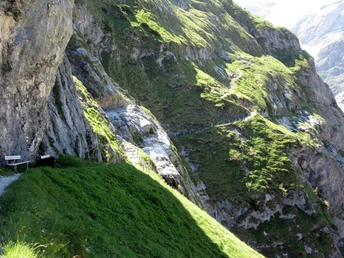
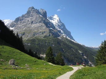
The trail winds leisurely from Pfingstegg across open meadows and through coniferous forest towards the glacier. As soon as the forest is left, the steep ascent to the hut begins. In the background, the snow-covered peaks of the Fiescherhörner can be seen. The trail becomes narrower and winds up curve by curve. Down in the valley on the right are the remains of the Lower Grindelwald Glacier. If you look closely you can see pieces of ice and the glacial lake.
Good to know
Pavements
Best to visit
Directions
Equipment
- hiking daypack (approx. 20 liters) with rain cover
- comfortable and sturdy footwear
- adequate and durable outdoor clothing in multiple layers
- sun and rain protection
- snacks and drinking water
- first aid kit
- penknife
- mobile phone
- if necesessary: telescope sticks, headlight, maps
Directions & Parking facilities
From the south, travel to the Jungfrau Region via the Grimsel or Susten Pass. Both passes are only open in summer. An alternative is the Simplon Pass with subsequent car transport through the Lötschberg tunnel.
Grindelwald
From Interlaken we follow the main road to Zweilütschinen. Here we turn left towards Grindelwald. The whole trip takes about 30 minutes and leads over a partly winding road
There are three public car parks: Parkhaus Eiger+ (252 parking spaces), Parkhaus Sportzentrum (160 parking spaces) and the new Terminal Parking (1000 spaces) of the V-Bahn. Alternatively, we can also use the car park in Grindelwald Grund.
Grindelwald
From Interlaken Ost railway station we reach Grindelwald without changing trains on the Bernese Oberland Bahn (BOB). Important: Get on the rear part of the train, as it splits in Zweilütschinen. If you get on at the front, you will end up in Lauterbrunnen. The journey takes 30 minutes to Grindelwald Terminal (V-Bahn). Three minutes later we are at the terminal in the village.
There are three stations in Grindelwald (Terminal, Grund and Dorf). The terminal station (Dorf) is in the centre of Grindelwald.
Additional information
License (master data)
Author´s Tip / Recommendation of the author
- Stay overnight at Berghaus Bäregg
- Pfingstegg
Safety guidelines
Map
Nearby
