


- 3:00 h
- 9.07 km
- 96 m
- 1,060 m
- 1,121 m
- 1,950 m
- 829 m
- Start: Niederhorn
- Destination: Beatenberg
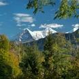
From the Niederhorn mountain station, the route first goes over the scenic ridge to the Alp Oberburgfeld. On wonderful hiking paths, you descend to the Alp Unterburgfeld. At the Unterburgfeld trail junction, we choose the path between the alpine huts and descend to the trail crossing at P.1527. Here we follow the signpost to Bire viewpoint. The path now leads eastward through sparse fir forest. After a short descent, the hiking trail turns and leads again westward between rock bands to the Bire. The summit of the distinctive rock tower is reached by a steep staircase. In addition to the magnificent views of Lake Thun and the Bernese high Alps, there are also benches on the small and shaded rocky plateau.
We descend from the Bire and continue westward on a partly quite exposed path along the cliff. At the first junction, we keep right and climb about 60 meters to the Bireflue signpost. On the left, you follow the hiking trail in the direction of Känzeli-Beatenberg, which continues for a while along the rock walls. At the next junction P.1421, you have left the Bireflue behind. On the left, you could descend to Beatenberg Wydi, but our route continues straight ahead. We reach an alpine road, and the white-red-white marked trail is replaced by yellow markings, which lead us downhill via Rossi back to the Beatenberg station.

Good to know
Pavements
Best to visit
Equipment
Directions & Parking facilities
Arrival: by bus from Thun station or Interlaken West station to the valley station Beatenbucht and by funicular to Beatenberg to the valley station of the Niederhorn cable car; or by bus from Interlaken-West station directly to Beatenberg.
Return trip: from the valley station by bus to Thun or Interlaken-West station
Literature
Hiking book Bernese Oberland by Bernese Hiking Trails
License (master data)
Safety guidelines
Map
Swisstopo hiking map 254T Interlaken 1:50,000
Nearby


")
")
")