
- 2:35 h
- 5.26 km
- 918 m
- 181 m
- 566 m
- 1,435 m
- 869 m
- Start: Interlaken Ost, railway station
- Destination: Harderbahn, Bergstation
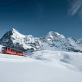
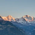
From Interlaken Ost, the hiking trail leads left to the Harderbahn valley station, eastwards towards Goldswil. The steep trail runs zigzag through the dense Buchenwald, via Ried to Hardergrat. Along the ridge, it now leads slightly downhill to the sun terrace of the Harder Kulm mountain house. It offers a fantastic view.
The descent can be tackled by train or by foot.

Good to know
Pavements
Best to visit
Directions
Equipment
Normale Wanderausrüstung, Wanderschuhe mit griffiger Sohle.
Directions & Parking facilities
Via Bern oder Luzern nach Interlaken. Von Süden via Grimselpass (nur im Sommer) oder via Simplonpass und Lötschberg-Autoverlad nach Interlaken.
Ungedeckter Parkplatz direkt neben dem Bahnhof Interlaken Ost.
An- und Abreise via Bahnhof Interlaken Ost.
Additional information
(in der gedruckten Sommer Panoramakarte der Jungfraubahnen)
License (master data)
Nearby


")
