
- 3:00 h
- 5.40 km
- 796 m
- 57 m
- 566 m
- 1,326 m
- 760 m
- Start: Interlaken Ost, Harderbahn valley station
- Destination: Harderbahn, Bergstation
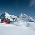
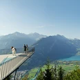
The footpath begins immediately to the left of the Harder funicular valley station. The wide path winds up to the Hohbüel pavilion at the end of the street where Felix Mendelssohn-Bartholdy once enjoyed the stunning views. From here, the hiking trail runs in the opposite direction, leisurely climbing along the slope towards Goldswil. After about 200 metres, the hiking trail crosses the Harder funicular and a little later the dirt road. On a clearing just before Goldswil, the trail then continues on a paved road to Goldswil. With the Burgseeli already in view on the right, the trail turns left away from the road into the forest and runs back in the opposite direction. Beyond the “Obere Bleiki” larch grove, the trail then follows a steep diagonal ascent, once again passing under the railway track, to a rest spot above the Hardermannli rock face. After another 20 minutes you reach the sunny terrace of the Harder Kulm restaurant where you are rewarded for your efforts by wonderful views and perhaps coffee and cake. The return to Interlaken takes eight minutes by funicular railway or about two hours on foot.

Good to know
Best to visit
Directions
Equipment
Directions & Parking facilities
Additional information
(in the printed summer panorama map of Jungfrau Railways)
License (master data)
Safety guidelines
Nearby


")
